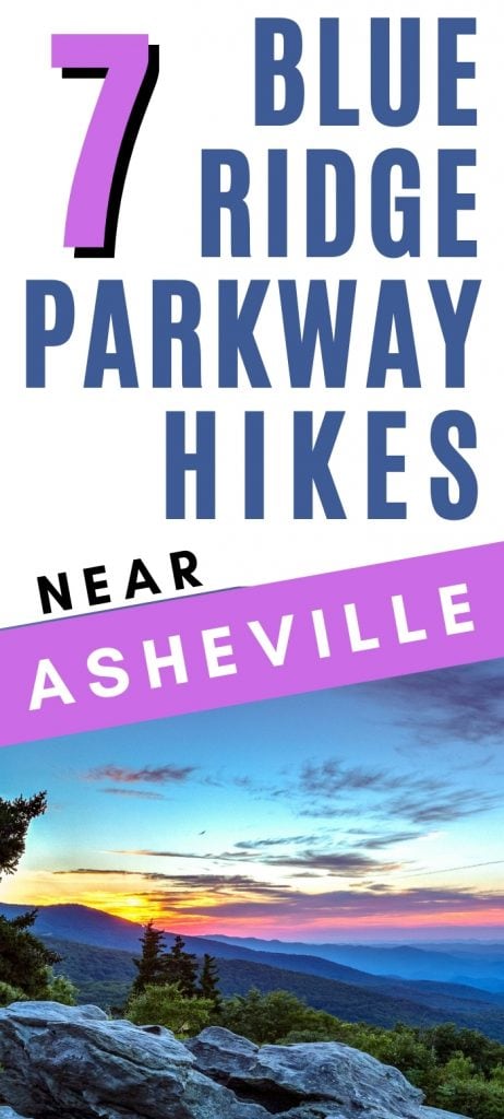
7 Best Blue Ridge Parkway Hikes near Asheville, NC (Short + Easy!)
Blue Ridge Parkway passes right through Asheville, NC, beckoning day trippers out for a fun day of driving with the windows down and hiking to stunning views.
Get your fill of beautiful mountain vistas, from sunrise to sunset, with these short and easy Blue Ridge Parkway hikes near Asheville.
This post may contain affiliate links. As an Amazon Associate and associate of other programs, I earn from qualifying purchases. This means if you click a link and make a purchase, I may earn a commission at no extra cost to you.
**Hurricane Helene Clean-up**
In September 2024, Hurricane Helene devastated Western North Carolina. Repair efforts are still ongoing in 2025, and some may continue on into 2026.
While much of the area is reopened and welcoming visitors, some areas are still closed. Check official websites for any closures before heading out. Here’s the Blue Ridge Parkway official NPS site to get you started.
What’s the Blue Ridge Parkway and Why Should I Care?
If you’ve never heard of the Blue Ridge Parkway, you are missing out on one of the most scenic drives in the United States. It’s the southeast’s premier road trip route: motorcycles, RVs, and everyday vehicles all love this drive.
Blue Ridge Parkway is a National Park Service (NPS) maintained roadway that connects Shenandoah National Park in Virginia to the North Carolina side of Great Smoky Mountains National Park.
The parkway is a continuous 469 miles through the mountains, passing through several national forests, multiple mountain ranges, and with access to Mt Mitchell, the highest mountain east of Colorado.
Asheville makes a great home base for exploring the North Carolina half of the Blue Ridge Parkway.
The city itself has many amenities, whether luxury or budget, and it’s just a smidge south of the exact middle of the North Carolina stretch of parkway. Perfect for exploring to the south one day and exploring north on the next day!
Best Blue Ridge Parkway Hikes near Asheville
While there are plenty of things to do in Asheville, exploring the nature surrounding it is worth it. Getting out of the city and exploring the mountains is an easy day trip from Asheville.
These hikes are all short, easy, and accessible from Blue Ridge Parkway, so you can not only drive this beautiful mountain route but also enjoy a hike to stretch your legs.
- Price Lake Loop Trail
- Rough Ridge via Tanawha Trail
- Beacon Heights
- Linville Falls
- Craggy Pinnacle Trail
- Graveyard Fields Loop Trail
- Waterrock Knob Summit
A day trip from Asheville generally doesn’t have enough time to go much further north than Boone or Blowing Rock, but it is possible to get up to Doughton Park if you’re determined. You’ll have to pick and choose your hikes and get an early start though.
Here are our recommendations for the best Blue Ridge Parkway trails near Asheville, starting at the north end and working south.
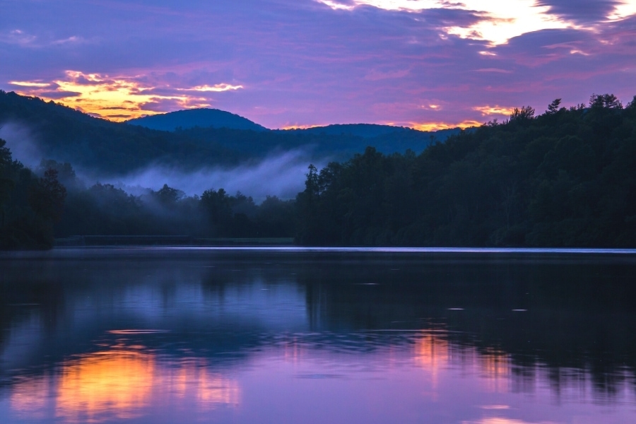
1. Price Lake Loop Trail
MM 297 / 2.7 Miles Roundtrip
Take a stroll around a beautiful mountain lake! This level path circles the lake for a peaceful and easy stroll. Reflections in the lake create beautiful photographs, and you’ll likely see waterfowl in the summer.
A full loop around the lake will take most people about an hour, give or take depending on how often you stop to take photos. If you’re short on time, walk a few minutes out and back so you get the good lake reflections.
Swimming in the lake is prohibited, but kayaking and canoeing are alright.
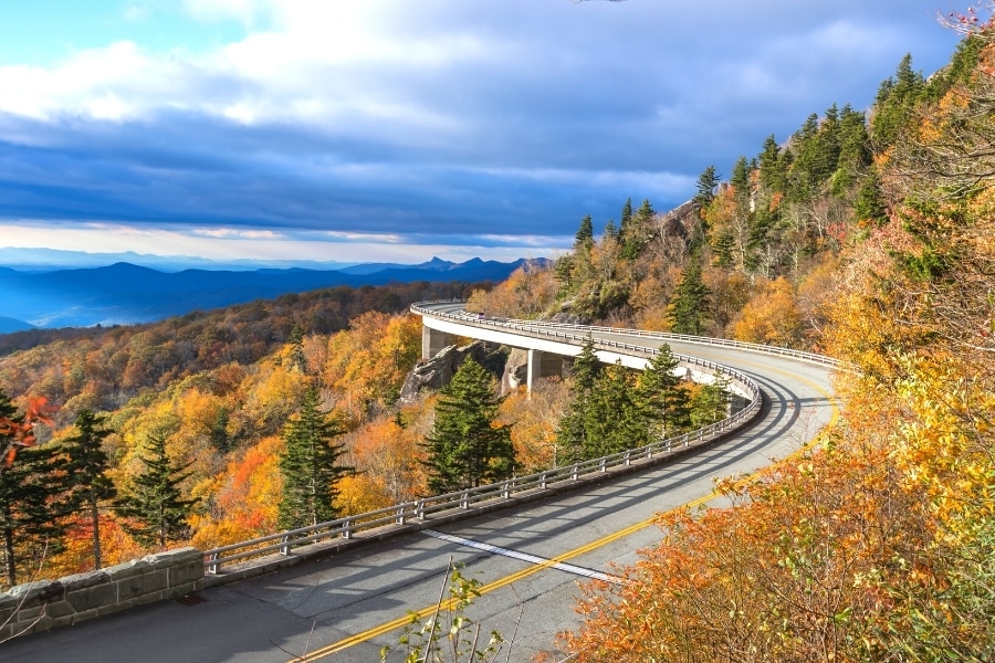
2. Rough Ridge via the Tanawha Trail
MM 303 / 1.0 Mile Roundtrip
Stunning views of Grandfather Mountain and the Linn Cove Viaduct are your reward for hiking at Rough Ridge.
A small parking lot provides access to the Tanawha Trail, a 13.5 mile-long trail connecting Beacon Heights to Price Lake. The Rough Ridge hike is meant to be a shorter out-and-back so you don’t have to hike the entire Tanawha Trail.
From the parking lot, Rough Ridge is a stone “step” and earth path that’s pretty steep going up, but the trail eventually opens up to wooden boardwalks and those wonderful views.
A very popular spot for watching the sunset! Andthe hike down is much less stressful. Bring a headlamp if you’re staying for sunset.
Bonus: There’s also a small waterfall at the parking lot.
3. Beacon Heights
MM 305.5 / 0.5 Miles Roundtrip
Excellent sunrise or sunset views! A short hike up stone steps from the parking lot reveals an open knob area with expansive mountain views. There are two open areas where the rock outcropping provides plenty of room to stretch out and enjoy the views.
Bring a picnic blanket and snacks or drinks, and enjoy the spot for a bit. Bring a headlamp if you’re visiting for sunrise or sunset.
4. Linville Falls
MM 316 / Varies by Path: 1.0 – 2.0 Miles roundtrip
Linville Falls has been a popular tourist destination since before the parkway existed. A small visitor center and restrooms are located at the parking lot, but the trails can also be accessed from the US Forest Service parking lot in the town of Linville Falls, off of the Blue Ridge Parkway.
Trails are wide with packed gravel for traction. There are short flights of stairs with hand rails at all viewpoints.
The Upper Falls path is the shortest and easiest route, and will always have the most people. See the double falls before the river converges and quickly disappears around a sharp bend before going over the cliff.
To see the lower falls, take the path up to the Chimney View for the absolute best view of the waterfall. From here, watch the falls tumble over the cliff and into the river that then flows through the Linville River Gorge and out of sight.
The Linville Gorge Trail runs on the other side of the valley and provides an up-close view of the Plunge Basin as well as the gorge floor.
For a more detailed look at everything you can experience at Linville Falls, check out this complete guide to Linville Falls.
5. Craggy Pinnacle Trail
MM 364 / 1.4 Miles roundtrip
Drive to the Craggy Dome Overlook, not the Craggy Gardens Visitor Center. The visitor center has restrooms and a small shop, and the Craggy Gardens Trail starts at the end of the parking lot. That is not the trail with the summit view.
The Craggy Pinnacle Trail is well shaded and mostly natural stone “steps” on an earthen path to the beautiful viewpoint at the top of the rock. The summit provides 360° panoramic views of both sides of the mountain range.
At one point the trail will come to a fork in the path: left leads up to the summit viewpoint but right leads to a second, lower viewpoint.
The right path is certainly the path less traveled, narrower and slightly more overgrown, but there’s a good chance you’ll have it all to yourself. Recommend checking out both viewpoints!
6. Graveyard Fields Loop Trail
MM 418 / 1.3 Miles roundtrip
Despite its name, there is no graveyard here. The area was once hit by a bad storm which killed a lot of trees, leaving behind only the gray stumps. These looked like gravestones sticking out of the hillside, so the area became known as Graveyard Fields.
Today, the trees have grown back and, buddy, do they put on a show every fall! A river runs through this shallow valley, and the Graveyard Fields Loop Trail takes you down to it and around the beautiful trees and flowers that bloom every summer.
There’s a large parking lot for Graveyard Fields, but it does get busy on weekends and during peak fall color. Restrooms are available here, too.
7. Waterrock Knob Summit Trail
MM 451 / 1.2 Miles roundtrip
The southernmost visitor center on the Blue Ridge Parkway, this spot is also the highest visitor center on the parkway. While the Richland Balsam overlook is the highest spot you can drive to on the parkway, the Waterrock Knob Summit is the highest spot you can hike to from the parkway.
(In this case, Mt Mitchell doesn’t count because you don’t typically hike up to Mt Mitchell’s summit from the parkway. You drive up and then hike a short distance from the parking lot to the summit.)
The Waterrock Knob Summit Hike is short, only 0.6 Miles to the top, but be warned: the first half of that is paved but steep. There’s a small “pedestrian overlook” before the trail turns to earth and rock and continues the rest of the way up to the summit.
Before you get worried that you can’t handle that, I passed plenty of white-haired older couples on this hike that managed just fine. Go at your own pace, and you’ll be fine, too. It’s not a race.
Navigating the Blue Ridge Parkway
Driving along Blue Ridge Parkway, scenic viewpoints are announced with “Overlook Ahead” signs on the side of the road.
However, they neglect to say which overlook is ahead. And with over 250 scenic overlooks along the roadside, the parkway maps don’t even attempt to label every overlook.
So, how do you find your way around to the best overlooks on Blue Ridge Parkway?
Mile markers are the answer. Blue Ridge Parkway’s mile markers are concrete posts with blue numbers. Be on the lookout for them as they’re often inconspicuously by themselves on the side of the road, sometimes in the brush.
Blue Ridge Parkway begins at Mile Marker (MM) 0 on the north end in Virginia and ends at MM 469 on the southern end in North Carolina. Numbers increase when driving south and decrease when driving north.
If you’re directionally challenged, this is a good way to confirm you’re traveling in the right direction. If you discover you’re going the wrong way, no problem! Turn around at the next overlook.
Explore the mountains on these Blue Ridge Parkway hikes near Asheville!
Looking for more interesting things to do in the area?
More Western North Carolina Travel Ideas
- Where to Stay in Asheville {Neighborhood Guide & Recs}
- 16 Can’t Miss Things to Do in Asheville, NC
- Driving Blue Ridge Parkway: Useful Tips + What to Expect
- 18 Best Overlooks on Blue Ridge Parkway
- 7 Best Short & Easy Blue Ridge Parkway Hikes near Asheville
- Is The Blowing Rock Worth It? {Honest Review}
- 9 Fun Things to Do in Little Switzerland, NC {A Blue Ridge Parkway town}
- 17 Easy-to-Reach Waterfalls in the Smoky Mountains
- Hiking the Laurel Falls Trail in Great Smoky Mountains National Park
- 5 Day Blue Ridge Parkway Itinerary: Start to Finish!
More Biltmore Travel Resources
- 35 Useful Tips for Visiting the Biltmore on a Budget
- Dining at Biltmore: The Best Biltmore Restaurants for Every Budget
- The Biltmore Gardens: When to Go & What to See
- Where to Find Discount Biltmore Tickets {9+ Places to Look}
- Is a Biltmore Annual Pass Worth It? {Cost Breakdown + Benefits}
- 6 Reasons to Visit the Biltmore
- Christmas at Biltmore: Don’t Miss this Magical Experience!
Happy Travels!

About the Author: Rachel Means
With six-figure student loan debt and only 10 PTO days per year, Rachel started traveling the world. A decade later, she’s paid off her loans, changed careers, and been to 42 US states and 17 countries. She’s an expert at planning and budgeting for travel and loves to help others do it, too! Read her full story here.
Share it!